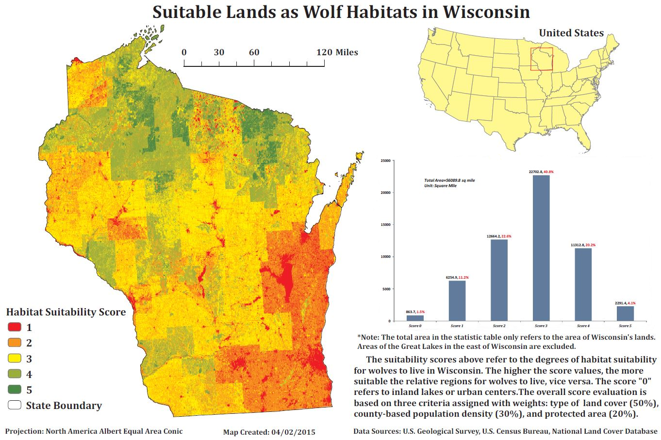
Type: Habitat Suitability Map (Raster-Based)
This is a map that I completed for briefly evaluating the land suitability levels for wolfs within Wisconsin.
In the study, three evaluation factors were considered into the relevant evaluation model, population density (county-based), land covers, and wolf activity frequencies.
As the conclusion of the study, one region's urbanization level (e.g. population density, land use structure) is inversely correlated with the habitat suitability for wolfs.
Tools Used: ArcGIS, Excel