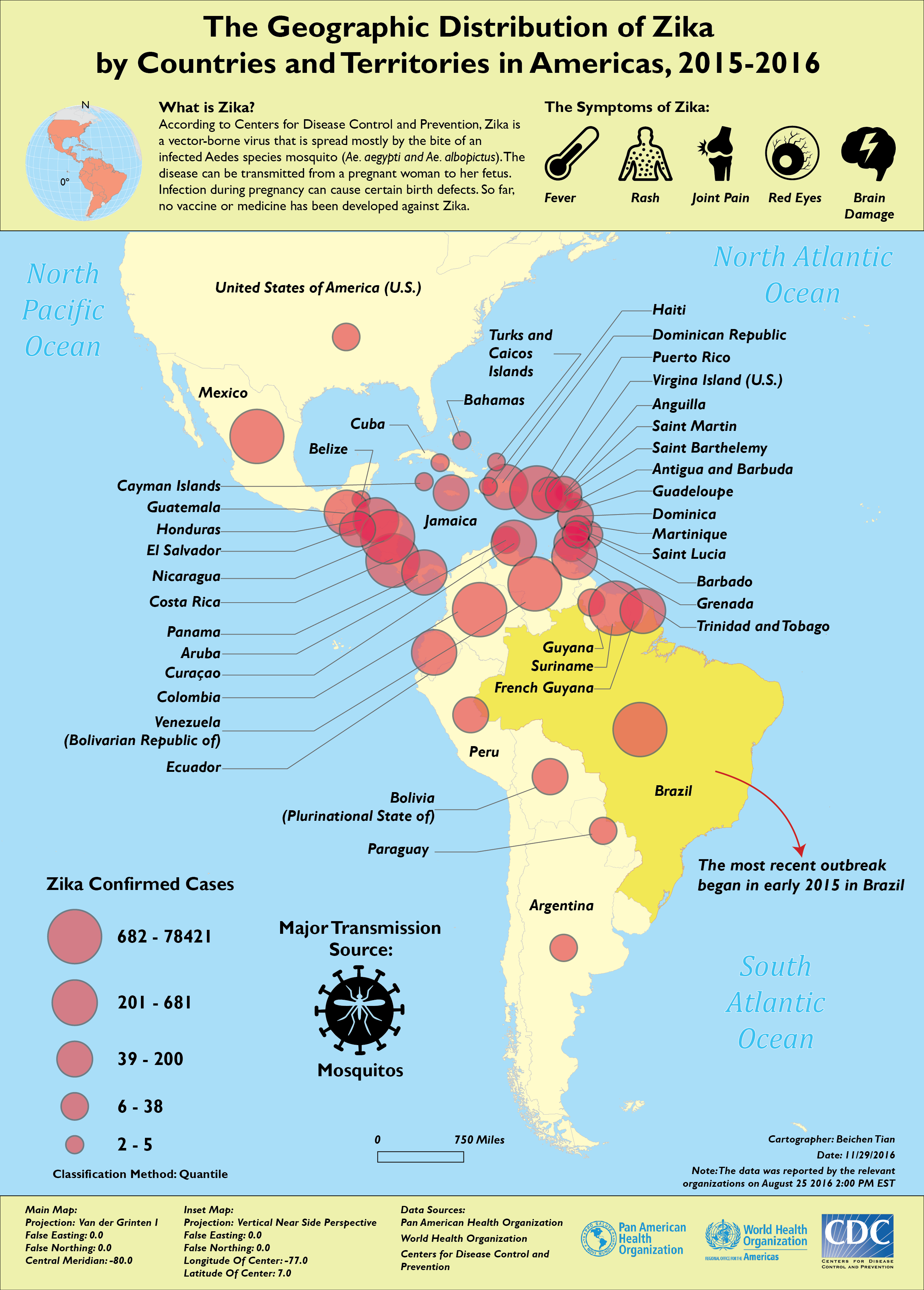
Type: Graduated Symbol Map
This is a map that shows the geographic distribution of Zika Virus across Americas since its most recent outbreak in early 2015 in Brazil.
The basic information and the main symptoms of Zika were introduced in the map.
The raw data was derived from the numbers of Zika confirmed cases of each countries / territories from the World Health Organization.
Tools Used: ArcGIS, Adobe Illustrator CC